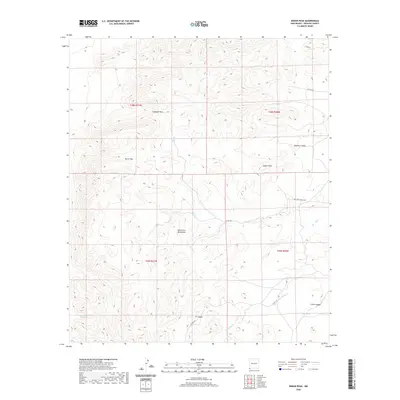
2020 Map of Indian Peak
USGS Topo · Published 2020About this map
Indian Peak stands as a prominent landmark in this corner of Hidalgo County, part of a landscape defined by the drainage patterns and rugged elevations of the Peloncillo Mountains. The map reveals a network of canyons including Dupree Canyon, Cabin Canyon, and XT Canyon, which channel seasonal water toward features like Big Cr and the S Fork Big Cr. Essential water sources in this arid environment are marked by Cottonwood Spring, Mud Springs, and the Birtrong Tank. Navigating this high-desert terrain is facilitated by geographic gaps such as Antelope Pass and Burro Pass. Human presence is evidenced primarily by remote infrastructure, with Big Creek Ranch Rd providing access across the range and several county roads connecting isolated points in the southwestern New Mexico backcountry.
Find a feature on this map
22 named features on this map. Tap any name to fly to it.
Don’t see what you’re looking for? This feature index may not catch every label — zoom into the map to look around manually.
Map Details
Editions of this 2020 Indian Peak Map
This is the sole edition of this map. No revisions or reprints were ever made.
Other maps of this area

1917 · Chiricahua
USGS Topo · 1:125,000

1918 · Animas Peak
USGS Topo · 1:62,500

1918 · Pratt
USGS Topo · 1:62,500

1919 · Pratt
USGS Topo · 1:62,500

1919 · Chiricahua
USGS Topo · 1:125,000

1920 · Animas Peak
USGS Topo · 1:62,500

1926 · Rodeo
USGS Topo · 1:62,500

1940 · Apache
USGS Topo · 1:62,500

1955 · Douglas
USGS Topo · 1:250,000

1958 · Apache
USGS Topo · 1:62,500