
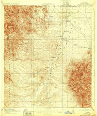
1920 Map of Animas Peak
USGS Topo · Published 1920About this map
The high desert landscape of the Animas Valley was defined by a ranching economy when this survey was conducted just after World War I. At the foot of the Animas Mountains, the terrain is marked by a network of family-named ranch sites and early homesteads, including the Gray Ranch and Howe Ranch. Educational centers like the Maddox School and Gray School served these widely dispersed cattle operations, which relied on water sources such as Horse Camp Wells and the ephemeral flows of Animas Creek.
Find a feature on this map
48 named features on this map. Tap any name to fly to it.
Don’t see what you’re looking for? This feature index may not catch every label — zoom into the map to look around manually.
Map Details
Editions of this 1920 Animas Peak Map
2 editions found
Other maps of this area

1917 · Chiricahua
USGS Topo · 1:125,000

1917 · Antelope Wells
USGS Topo · 1:62,500

1918 · Walnut Wells
USGS Topo · 1:62,500

1918 · Cienega Springs
USGS Topo · 1:62,500

1918 · Playas
USGS Topo · 1:62,500

1918 · Animas Peak
USGS Topo · 1:62,500

1918 · Pratt
USGS Topo · 1:62,500

1919 · Pratt
USGS Topo · 1:62,500

1919 · Playas
USGS Topo · 1:62,500

1919 · Antelope Wells
USGS Topo · 1:62,500