
1918 Map of Walnut Wells
USGS Topo · Published 1918About this map
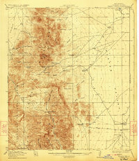
Animas Range peaks and the broad floor of the Playas Valley dominate this southwestern New Mexico landscape during the late years of World War I. This era marks a peak of localized ranching and mining activity, with the map recording a dense network of family cattle operations such as the Lane Ranch, Seven K Ranch, and O K Bar Ranch. Evidence of the region’s mineral interest is clear at the Gillespie Mine and the already Red Hill Mine (abandoned) near the eastern foothills.
Find a feature on this map
59 named features on this map. Tap any name to fly to it.
Don’t see what you’re looking for? This feature index may not catch every label — zoom into the map to look around manually.
Map Details
Editions of this 1918 Walnut Wells Map
3 editions found
Other maps of this area

1917 · Antelope Wells
USGS Topo · 1:62,500

1918 · Big Hatchet Peak
USGS Topo · 1:62,500

1918 · Hachita
USGS Topo · 1:62,500

1918 · Dog Mountains
USGS Topo · 1:62,500

1918 · Cienega Springs
USGS Topo · 1:62,500

1918 · Playas
USGS Topo · 1:62,500

1918 · Animas Peak
USGS Topo · 1:62,500

1918 · Pratt
USGS Topo · 1:62,500

1919 · Pratt
USGS Topo · 1:62,500

1919 · Playas
USGS Topo · 1:62,500