
1918 Map of Playas
USGS Topo · Published 1961About this map
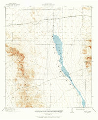
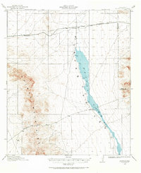
Playas Lake dominates the central basin of this New Mexico landscape, appearing as a seasonal catchment at the foot of the Animas Mountains. The mapping, conducted by surveyors like A.L. Ackers and W.R. Chenoweth just before 1920, captures the early transportation and ranching footprint of the Playas Valley. The El Paso and Southwestern railroad cuts across the northern terrain, connecting the small settlement of Playas and the rail stop at Antelope. Southward, the influence of early cattle operations is evident through markers like Whitmire Ranch and Whitmire Pass, providing a clear look at how the region's geography dictated the placement of water sources and transit corridors between the mountain ranges and the ephemeral lake bed.
Find a feature on this map
9 named features on this map. Tap any name to fly to it.
Don’t see what you’re looking for? This feature index may not catch every label — zoom into the map to look around manually.
Map Details
Editions of this 1918 Playas Map
3 editions found
Other maps of this area

1918 · Big Hatchet Peak
USGS Topo · 1:62,500

1918 · Hachita
USGS Topo · 1:62,500

1918 · Walnut Wells
USGS Topo · 1:62,500

1918 · Animas Peak
USGS Topo · 1:62,500

1918 · Pratt
USGS Topo · 1:62,500

1919 · Pratt
USGS Topo · 1:62,500

1919 · Playas
USGS Topo · 1:62,500

1920 · Animas Peak
USGS Topo · 1:62,500

1923 · Walnut Wells
USGS Topo · 1:62,500

1954 · Silver City
USGS Topo · 1:250,000