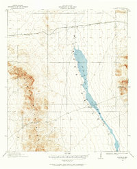
1918 Map of Playas
USGS Topo · Published 1964About this map
Playas Lake dominates this high-desert basin, stretching as a massive ephemeral feature through the center of the survey. The landscape is defined by the sharp vertical rise of the Animas Mountains to the west, where Whitmire Pass provides a navigable break in the range. This 1917-1918 survey documents the infrastructure of the borderlands during a period of expanding rail and ranching operations. The El Paso and Southwestern railroad cuts across the northern flats, supporting isolated settlements like Playas and Antelope. South of the lake, the presence of Whitmire Ranch indicates the early pastoral development of this arid region. The boundary between Grant and Hidalgo Counties is clearly marked, recording the administrative layout of this corner of New Mexico shortly after statehood.
Find a feature on this map
9 named features on this map. Tap any name to fly to it.
Don’t see what you’re looking for? This feature index may not catch every label — zoom into the map to look around manually.
Map Details
Editions of this 1918 Playas Map
3 editions found
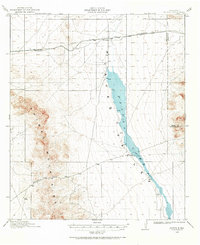
Other maps of this area

1918 · Big Hatchet Peak
USGS Topo · 1:62,500

1918 · Hachita
USGS Topo · 1:62,500

1918 · Walnut Wells
USGS Topo · 1:62,500

1918 · Playas
USGS Topo · 1:62,500

1918 · Animas Peak
USGS Topo · 1:62,500

1918 · Pratt
USGS Topo · 1:62,500

1919 · Pratt
USGS Topo · 1:62,500

1919 · Playas
USGS Topo · 1:62,500

1920 · Animas Peak
USGS Topo · 1:62,500

1923 · Walnut Wells
USGS Topo · 1:62,500