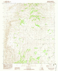
1982 Map of Indian Peak
USGS Topo · Published 1983About this map
Gray Mountain and Indian Peak define the high relief of this Hidalgo County landscape as it appeared in the late 1970s and early 1980s. The region is characterized by a complex network of drainages and water management points, including Big Creek, which is fed by the Rough Fork and South Fork. This arid terrain required strategic water resources for ranching or local use, evidenced by the presence of Birtrong Tank, Orchard Tank, and Mud Spring.
Find a feature on this map
13 named features on this map. Tap any name to fly to it.
Don’t see what you’re looking for? This feature index may not catch every label — zoom into the map to look around manually.
Map Details
Editions of this 1982 Indian Peak Map
This is the sole edition of this map. No revisions or reprints were ever made.
Other maps of this area

1917 · Chiricahua
USGS Topo · 1:125,000

1918 · Animas Peak
USGS Topo · 1:62,500

1918 · Pratt
USGS Topo · 1:62,500

1919 · Pratt
USGS Topo · 1:62,500

1919 · Chiricahua
USGS Topo · 1:125,000

1920 · Animas Peak
USGS Topo · 1:62,500

1926 · Rodeo
USGS Topo · 1:62,500

1940 · Apache
USGS Topo · 1:62,500

1955 · Douglas
USGS Topo · 1:250,000

1958 · Apache
USGS Topo · 1:62,500