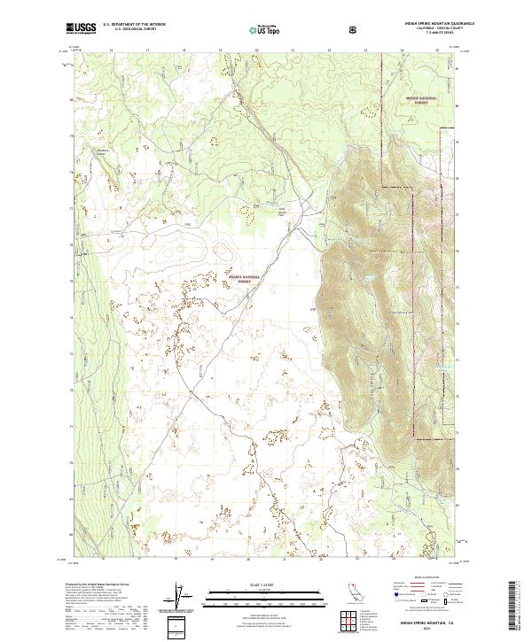
2021 Map of Indian Spring Mountain
USGS Topo · Published 2021About this map
Whitehorse Mountains and the volcanic peak of Indian Spring Mtn dominate this high-altitude landscape within the Modoc National Forest and Shasta National Forest. The map documents a transition between complex geological formations, notably the Lava Spur Aka Porcupine Butte and the marshy terrain of Hambone Island. Water resources are sparse but critical in this region, marked by named features like Indian Spring, Mayfield Spring, and the seasonal Wet Weather Lake. This 2021 update traces the modern infrastructure cutting through the wilderness, including the Pit Gas Pipe and forest routes like Mayfield (FAD). The topographical detail clarifies the drainage patterns of Shake Canyon and Tuft Cr amidst the broad expanses of Julia Glover Flat.
Find a feature on this map
21 named features on this map. Tap any name to fly to it.
Don’t see what you’re looking for? This feature index may not catch every label — zoom into the map to look around manually.
Map Details
Editions of this 2021 Indian Spring Mountain Map
This is the sole edition of this map. No revisions or reprints were ever made.
Other maps of this area

1886 · Modoc Lava Bed
USGS Topo · 1:250,000

1892 · Modoc Lava-Bed
USGS Topo · 1:250,000

1932 · Bartle
USGS Topo · 1:96,000

1939 · Bartle
USGS Topo · 1:125,000

1954 · Alturas
USGS Topo · 1:250,000

1958 · Alturas
USGS Topo · 1:250,000

1961 · Hambone
USGS Topo · 1:62,500

1961 · Pondosa
USGS Topo · 1:62,500

1961 · Fall River Mills
USGS Topo · 1:62,500

1962 · Alturas
USGS Topo · 1:250,000