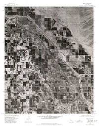
1975 Map of Indio
USGS Topo · Published 1977About this map
The agricultural landscape of the Coachella Valley is captured here in sharp detail during the mid-1970s, revealing the dense patchwork of irrigated fields that drove the regional economy. Centered on the growing hub of Indio, the orthophotoquad format provides a rare photographic perspective of the desert floor being transformed by industrial-scale farming. To the southeast, the smaller settlements of Coachella and Thermal appear as concentrated hubs amidst the grid of orchards and crops, illustrating the stark line between the green valley floor and the arid Indio Hills to the north. This document, produced by the Geological Survey in cooperation with the Soil Conservation Service, serves as a precise record of land use and irrigation patterns before the significant suburban expansion of later decades.
Find a feature on this map
5 named features on this map. Tap any name to fly to it.
Don’t see what you’re looking for? This feature index may not catch every label — zoom into the map to look around manually.
Map Details
Editions of this 1975 Indio Map
This is the sole edition of this map. No revisions or reprints were ever made.
Other maps of this area

1904 · Indio
USGS Topo · 1:125,000

1941 · Toro Peak
USGS Topo · 1:62,500

1941 · Coachella
USGS Topo · 1:62,500

1941 · Edom
USGS Topo · 1:62,500

1943 · Coachella
USGS Topo · 1:62,500

1944 · Toro peak
USGS Topo · 1:62,500

1944 · Edom
USGS Topo · 1:62,500

1944 · Pinyon Well
USGS Topo · 1:62,500

1947 · Santa Ana
USGS Topo · 1:250,000

1949 · Santa Ana
USGS Topo · 1:250,000