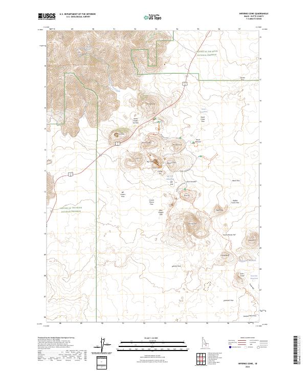
2024 Map of Inferno Cone
USGS Topo · Published 2024About this map
The volcanic landscape of Butte County is defined by the expansive Craters of the Moon National Preserve and the Craters of the Moon National Wilderness Area. Volcanic activity is evident through numerous named features including the Blue Dragon Flow, Black Flow, and the Serrate Flow. Prominent landmarks such as Inferno Cone, Big Cinder Butte, and Echo Crater rise above the surrounding flats.
Find a feature on this map
53 named features on this map. Tap any name to fly to it.
Don’t see what you’re looking for? This feature index may not catch every label — zoom into the map to look around manually.
Map Details
Editions of this 2024 Inferno Cone Map
This is the sole edition of this map. No revisions or reprints were ever made.
Other maps of this area

1935 · MacKay
USGS Topo · 1:96,000

1955 · Idaho Falls
USGS Topo · 1:250,000

1958 · Idaho Falls
USGS Topo · 1:250,000

1960 · Grouse
USGS Topo · 1:62,500

1972 · North Laidlaw Butte
USGS Topo · 1:24,000

1972 · Little Park
USGS Topo · 1:24,000

1972 · Nichols Reservoir
USGS Topo · 1:24,000

1972 · Inferno Cone
USGS Topo · 1:24,000

1972 · Blizzard Mtn South
USGS Topo · 1:24,000
1973 · Fissure Butte
USGS Topo · 1:24,000