
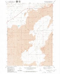
1972 Map of Blizzard Mtn South
USGS Topo · Published 1976About this map
Pioneer Mountains terrain dominates this 1972 survey of the high-elevation boundary between Butte and Blaine counties. The landscape is characterized by its volcanic history, with expansive Lava flows and the small Lava Lake settled at an elevation of 5,158 feet. Water sources are critical here, evidenced by numerous named flows such as East Fork Fish Creek, Lava Creek, and Payne Creek, alongside scattered springs that supported high-country activity.
Find a feature on this map
20 named features on this map. Tap any name to fly to it.
Don’t see what you’re looking for? This feature index may not catch every label — zoom into the map to look around manually.
Map Details
Editions of this 1972 Blizzard Mtn South Map
This is the sole edition of this map. No revisions or reprints were ever made.
Other maps of this area

1935 · MacKay
USGS Topo · 1:96,000

1955 · Idaho Falls
USGS Topo · 1:250,000

1958 · Idaho Falls
USGS Topo · 1:250,000

1960 · Muldoon Canyon
USGS Topo · 1:62,500

1960 · Grouse
USGS Topo · 1:62,500

1972 · North Laidlaw Butte
USGS Topo · 1:24,000

1972 · Little Park
USGS Topo · 1:24,000

1972 · Inferno Cone
USGS Topo · 1:24,000

1978 · Craters Of The Moon
USGS Topo · 1:100,000
1979 · Paddelford Flat
USGS Topo · 1:24,000