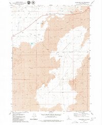
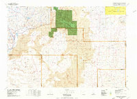
1979 Map of Paddelford Flat
USGS Topo · Published 1979About this map
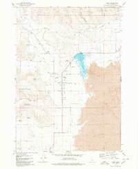
Paddelford Flat dominates this Idaho landscape, characterized by expansive Lava flows that define the local topography. This 1970s survey illustrates a specialized high-desert ranching and resource-extraction economy, marked by the presence of Huff Creek Corral and another unnamed corral near the northern spring. Water sources are critical in this arid environment, evidenced by Wheatly Pond, Huff Lake, and the ephemeral Paddelford Flat Lake. Thermal activity is noted at the Hot Spring near the eastern margin, while transportation is limited to High Hill Road and various Jeep Trails cutting through the volcanic terrain. Industrial activity is visible through several scattered Gravel Pits and a Borrow Pit, reflecting the area's utility during the mid-to-late 20th century.
Find a feature on this map
17 named features on this map. Tap any name to fly to it.
Don’t see what you’re looking for? This feature index may not catch every label — zoom into the map to look around manually.
Map Details
Editions of this 1979 Paddelford Flat Map
This is the sole edition of this map. No revisions or reprints were ever made.
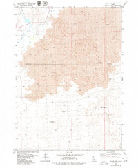
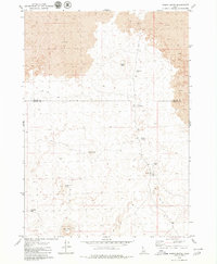
Other maps of this area

1955 · Idaho Falls
USGS Topo · 1:250,000

1958 · Idaho Falls
USGS Topo · 1:250,000
1972 · Little Park
USGS Topo · 1:24,000
1972 · Laidlaw Butte
USGS Topo · 1:24,000
1972 · Blizzard Mtn South
USGS Topo · 1:24,000
1978 · Craters Of The Moon
USGS Topo · 1:100,000
1979 · Pagari Well
USGS Topo · 1:24,000
1979 · Wagon Butte
USGS Topo · 1:24,000
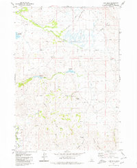
1979 · Lake Hills
USGS Topo · 1:24,000
1979 · Carey
USGS Topo · 1:24,000