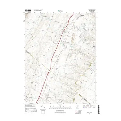
2016 Map of Inwood
USGS Topo · Published 2016About this map
Gerrardstown and the community of Inwood anchor this landscape along the eastern slopes of North Mountain, where the Shenandoah Valley transitions across the state line between West Virginia and Virginia. The 2016 survey documents a region characterized by a high density of named water sources and springs, such as Douglas Miller Farm Spring and Lee Whitacre Farm Spring, which historically supported the valley's renowned orchard economy. The settlement pattern is deeply rooted in local genealogy, evidenced by numerous small burial grounds and meeting houses scattered through the countryside.
Find a feature on this map
202 named features on this map. Tap any name to fly to it.
Don’t see what you’re looking for? This feature index may not catch every label — zoom into the map to look around manually.
Map Details
Editions of this 2016 Inwood Map
This is the sole edition of this map. No revisions or reprints were ever made.
Other maps of this area

1884 · Harpers Ferry
USGS Topo · 1:125,000

1891 · Harpers Ferry
USGS Topo · 1:125,000

1893 · Harpers Ferry
USGS Topo · 1:125,000

1894 · Winchester
USGS Topo · 1:125,000

1914 · Martinsburg
USGS Topo · 1:48,000

1914 · Gerrardstown
USGS Topo · 1:48,000

1916 · Gerrardstown
USGS Topo · 1:62,500

1916 · Martinsburg
USGS Topo · 1:62,500

1916 · Berryville
USGS Topo · 1:62,500

1937 · Gerrardstown
USGS Topo · 1:48,000