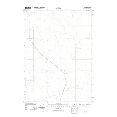
2012 Map of Iona
USGS Topo · Published 2012About this map
The small community of Iona sits at the junction of 266th Street and Highway 47, serving as a quiet focal point in the expansive landscape of Lyman County. The terrain transitions from the broad expanse of Gozzard Flat in the north toward the rising elevations of the Iona Hills and the prominent Twilight Butte in the south. This 2012 survey illustrates a landscape defined by ranching and rural life, where water sources like Waterhole Cr and Nicholas Cr meander through the prairie. Near the settlement, Iona Cem provides a local genealogical touchpoint, while Lake Agnes offers a rare permanent water feature in this portion of the South Dakota plains. The map's grid of section roads, including 336th Ave and 340th Ave, underscores the organized agricultural development of the region.
Find a feature on this map
12 named features on this map. Tap any name to fly to it.
Don’t see what you’re looking for? This feature index may not catch every label — zoom into the map to look around manually.
Map Details
Editions of this 2012 Iona Map
This is the sole edition of this map. No revisions or reprints were ever made.
Other maps of this area

1940 · Iona
USGS Topo · 1:62,500

1944 · Iona
USGS Topo · 1:62,500

1952 · Hamill NE
USGS Topo · 1:24,000

1952 · Iona NW
USGS Topo · 1:24,000

1955 · Mitchell
USGS Topo · 1:250,000

1959 · Mitchell
USGS Topo · 1:250,000

1971 · Hamill SE
USGS Topo · 1:24,000

1971 · Rattlesnake Butte East
USGS Topo · 1:24,000

1971 · Dixon
USGS Topo · 1:24,000

1971 · Dixon NE
USGS Topo · 1:24,000