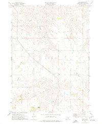
1974 Map of Iona
USGS Topo · Published 1977About this map
Iona serves as the primary focal point of this mid-1970s survey, situated along the north-south route of State Highway 47. The surrounding landscape is defined by the Iona Hills, where drainage patterns create a network of seasonal waterways such as Waterhole Creek and Nicholas Creek. The local economy of the time is visible through numerous Gravel Pits and a specific Drill Hole located east of the main settlement.
Find a feature on this map
12 named features on this map. Tap any name to fly to it.
Don’t see what you’re looking for? This feature index may not catch every label — zoom into the map to look around manually.
Map Details
Editions of this 1974 Iona Map
This is the sole edition of this map. No revisions or reprints were ever made.
Other maps of this area

1940 · Iona
USGS Topo · 1:62,500

1944 · Iona
USGS Topo · 1:62,500

1952 · Hamill NE
USGS Topo · 1:24,000

1952 · Iona NW
USGS Topo · 1:24,000

1955 · Mitchell
USGS Topo · 1:250,000

1959 · Mitchell
USGS Topo · 1:250,000

1971 · Hamill SE
USGS Topo · 1:24,000

1971 · Rattlesnake Butte East
USGS Topo · 1:24,000

1971 · Dixon
USGS Topo · 1:24,000

1971 · Dixon NE
USGS Topo · 1:24,000