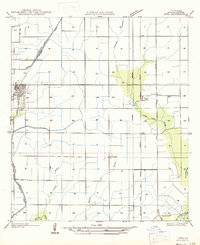
1947 Map of Iota
USGS Topo · Published 1947About this map
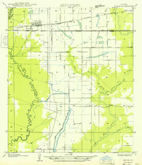
Iota serves as the primary hub of this prairie landscape in Acadia Parish, where the grid-based agricultural layout is defined by a sophisticated water management system. The prominent Irrigation Canal and natural waterways like Grande Coulee and Andre Coulee reflect the region's reliance on rice cultivation and water control. This network of land and water is bisected by major rail corridors, including the Southern Pacific and Missouri Pacific, which facilitated the movement of goods from small loading points like Keystone and Maxie. Local history is anchored by family-named sites such as McCain Cem and Gunther Cem, situated among small crossroads settlements like Ellis and Egan. To the southeast, the terrain softens as it nears the natural curves of Bayou Plaquemine Brule, marking the transition from engineered farmland to the native wetlands of the Gulf Coast plain.
Find a feature on this map
22 named features on this map. Tap any name to fly to it.
Don’t see what you’re looking for? This feature index may not catch every label — zoom into the map to look around manually.
Map Details
Editions of this 1947 Iota Map
This is the sole edition of this map. No revisions or reprints were ever made.
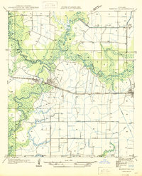
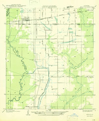
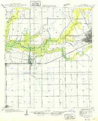
Other maps of this area

1935 · Branch
USGS Topo · 1:31,680
1946 · Mermentau
USGS Topo · 1:31,680

1946 · Rayne
USGS Topo · 1:31,680

1947 · Evangeline
USGS Topo · 1:31,680

1947 · Branch
USGS Topo · 1:31,680

1947 · Eunice
USGS Topo · 1:31,680

1947 · Pitreville
USGS Topo · 1:31,680
1947 · Basile
USGS Topo · 1:31,680
1949 · Estherwood
USGS Topo · 1:31,680
1949 · Basile
USGS Topo · 1:31,680