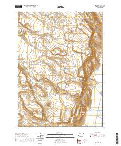
2020 Map of Irish Lake
USGS Topo · Published 2020About this map
Irish Lake sits at the center of this high desert landscape, surrounded by a network of seasonal water sources and grazing lands. The eastern edge of the map is defined by the Blitzen Valley, where the Donner und Blitzen River and the Warm Springs Canal provide a more consistent water supply than the interior basins. The terrain is marked by significant volcanic features and depressions, most notably Hole in the Ground and Hoghouse Canyon.
Find a feature on this map
32 named features on this map. Tap any name to fly to it.
Don’t see what you’re looking for? This feature index may not catch every label — zoom into the map to look around manually.
Map Details
Editions of this 2020 Irish Lake Map
This is the sole edition of this map. No revisions or reprints were ever made.
Other maps of this area

1955 · Burns
USGS Topo · 1:250,000

1955 · Adel
USGS Topo · 1:250,000

1957 · Adel
USGS Topo · 1:250,000

1958 · Burns
USGS Topo · 1:250,000

1958 · Adel
USGS Topo · 1:250,000

1959 · Burns
USGS Topo · 1:250,000

1962 · Adel
USGS Topo · 1:250,000

1967 · Krumbo Reservoir
USGS Topo · 1:24,000

1967 · Jackass Butte
USGS Topo · 1:24,000

1967 · Frenchglen
USGS Topo · 1:24,000