
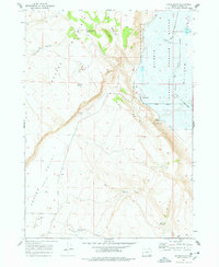
1967 Map of Frenchglen
USGS Topo · Published 1972About this map
Frenchglen sits at the dramatic intersection of the Jackass Mountains and the wetlands of the Malheur National Wildlife Refuge. This late-1960s survey illustrates a landscape defined by water management and conservation in high-desert Oregon. The Donner und Blitzen River winds through the eastern flats, supported by the Bridge Creek Canal and the Center Patrol Road which navigate the refuge. To the west, the steep escarpments of Steens Mountain and P Hill give way to the Catlow Valley. Remnants of earlier ranching and pioneer life appear through markers like Brenton Cabin and the P Ranch, alongside the Lookout Tower monitoring the surrounding terrain. Scattered water sources, including Kundert Reservoir and Griffith Spring Reservoir, highlight the essential infrastructure required for survival and industry in this arid environment.
Find a feature on this map
30 named features on this map. Tap any name to fly to it.
Don’t see what you’re looking for? This feature index may not catch every label — zoom into the map to look around manually.
Map Details
Editions of this 1967 Frenchglen Map
2 editions found
Other maps of this area

1955 · Adel
USGS Topo · 1:250,000

1957 · Adel
USGS Topo · 1:250,000

1958 · Adel
USGS Topo · 1:250,000

1962 · Adel
USGS Topo · 1:250,000

1967 · Krumbo Reservoir
USGS Topo · 1:24,000

1967 · Roaring Springs
USGS Topo · 1:24,000
1967 · Irish Lake
USGS Topo · 1:24,000

1967 · Page Springs
USGS Topo · 1:24,000

1968 · Tombstone Canyon
USGS Topo · 1:24,000
1971 · Keg Sprs Valley East
USGS Topo · 1:24,000