1967 Map of Frenchglen
USGS Topo · Published 1978About this map
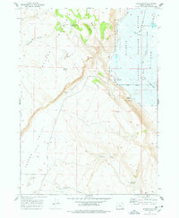
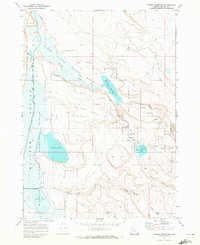
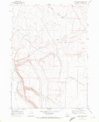
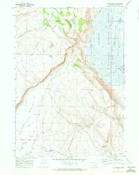
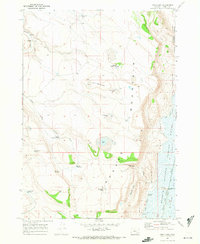
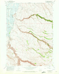
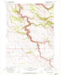
Frenchglen sits at the base of P Hill, serving as a gateway to the high desert terrain of Harney County. This 1960s mapping record highlights the vital water management systems of the era, including the Warm Springs Canal and various upland catchments like Griffith Spring Reservoir and Kundert Reservoir. The eastern edge of the map is dominated by the Malheur National Wildlife Refuge, where the Donner und Blitzen River flows through a landscape structured by ranching and conservation history. Evidence of early settlement and land use is found at the P Ranch and Brenton Cabin, while the rugged Jackass Mountains rise to the west. The presence of a landing strip near the settlement and the remote Steens Mountain Loop Road reflect the specialized transportation needs of this high-altitude basin.
Find a feature on this map
29 named features on this map. Tap any name to fly to it.
Don’t see what you’re looking for? This feature index may not catch every label — zoom into the map to look around manually.
Map Details
Editions of this 1967 Frenchglen Map
2 editions found
Other maps of this area

1955 · Adel
USGS Topo · 1:250,000

1957 · Adel
USGS Topo · 1:250,000

1958 · Adel
USGS Topo · 1:250,000

1962 · Adel
USGS Topo · 1:250,000
1967 · Krumbo Reservoir
USGS Topo · 1:24,000
1967 · Roaring Springs
USGS Topo · 1:24,000
1967 · Frenchglen
USGS Topo · 1:24,000
1967 · Irish Lake
USGS Topo · 1:24,000
1967 · Page Springs
USGS Topo · 1:24,000
1968 · Tombstone Canyon
USGS Topo · 1:24,000