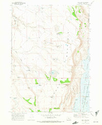
1967 Map of Irish Lake
USGS Topo · Published 1972About this map
Jackass Mountain dominates the central portion of this 1960s Harney County landscape, representing a high desert environment shaped by seasonal water and cattle ranching. The presence of the M S Davies Ranch and numerous water improvements like Black Rim Dam, Upper Jack Creek Res, and the Company Trough highlight the vital infrastructure required for livestock in this arid basin. To the east, the terrain drops toward the Donner und Blitzen River valley and the Malheur National Wildlife Refuge. The map details a network of ephemeral basins and springs including Irish Lake, Marshall Lake, and John Cabin Spring. Curious geological and topographic features such as the Hole in the Ground and Hoghouse Canyon add character to the survey, while a Radio Facility and various Jeep Trails suggest the mid-century modernization of this remote area.
Find a feature on this map
32 named features on this map. Tap any name to fly to it.
Don’t see what you’re looking for? This feature index may not catch every label — zoom into the map to look around manually.
Map Details
Editions of this 1967 Irish Lake Map
This is the sole edition of this map. No revisions or reprints were ever made.
Other maps of this area

1955 · Burns
USGS Topo · 1:250,000

1955 · Adel
USGS Topo · 1:250,000

1957 · Adel
USGS Topo · 1:250,000

1958 · Burns
USGS Topo · 1:250,000

1958 · Adel
USGS Topo · 1:250,000

1959 · Burns
USGS Topo · 1:250,000

1962 · Adel
USGS Topo · 1:250,000

1967 · Krumbo Reservoir
USGS Topo · 1:24,000

1967 · Jackass Butte
USGS Topo · 1:24,000

1967 · Frenchglen
USGS Topo · 1:24,000