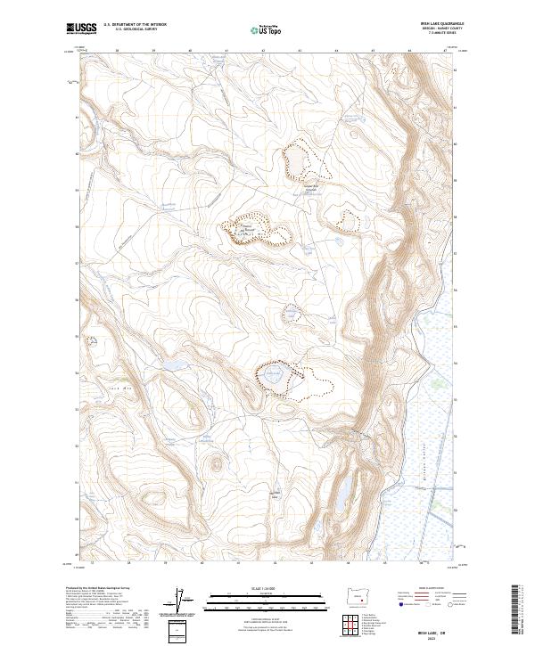
2023 Map of Irish Lake
USGS Topo · Published 2023About this map
The Malheur National Wildlife Refuge anchors the eastern edge of this High Desert landscape, where the Blitzen Valley meets the volcanic uplands of the Catlow Valley region. Water management is the defining characteristic of this arid terrain, evidenced by the Warm Springs Canal and a network of isolated springs and livestock-related improvements. Features like John Cabin Spring, Company Trough, and the Bailey Waterhole reflect the long history of range management and cattle ranching in Harney County. The topography is dominated by basaltic landmarks, most notably the Jack Mountain ridge and the descriptively named Hole-in the Ground Jackass Mtn. Seasonally fluctuating water bodies, including Irish Lake and Antelope Lake, provide critical habitat in an otherwise dry expanse of sagebrush and juniper bed grounds.
Find a feature on this map
32 named features on this map. Tap any name to fly to it.
Don’t see what you’re looking for? This feature index may not catch every label — zoom into the map to look around manually.
Map Details
Editions of this 2023 Irish Lake Map
This is the sole edition of this map. No revisions or reprints were ever made.
Other maps of this area

1955 · Burns
USGS Topo · 1:250,000

1955 · Adel
USGS Topo · 1:250,000

1957 · Adel
USGS Topo · 1:250,000

1958 · Burns
USGS Topo · 1:250,000

1958 · Adel
USGS Topo · 1:250,000

1959 · Burns
USGS Topo · 1:250,000

1962 · Adel
USGS Topo · 1:250,000
1967 · Krumbo Reservoir
USGS Topo · 1:24,000
1967 · Jackass Butte
USGS Topo · 1:24,000
1967 · Frenchglen
USGS Topo · 1:24,000