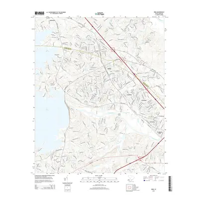
2014 Map of Irmo
USGS Topo · Published 2014About this map
The sprawling shoreline of Lake Murray defines the western edge of this 2014 survey, where the suburban growth of the mid-2010s meets the older agricultural and ecclesiastical roots of the region. Local heritage is deeply anchored by historical burial grounds and congregations such as Salem Church, Salem Cem, and Bauknight Cem near Ballentine. The landscape transitions from the developed neighborhoods of Irmo and Whitehall toward the complex drainage systems of Twelvemile Cr and Fourteenmile Cr as they flow toward the Saluda River.
Find a feature on this map
31 named features on this map. Tap any name to fly to it.
Don’t see what you’re looking for? This feature index may not catch every label — zoom into the map to look around manually.
Map Details
Editions of this 2014 Irmo Map
This is the sole edition of this map. No revisions or reprints were ever made.
Other maps of this area

1904 · Columbia
USGS Topo · 1:125,000

1941 · Spartanburg
USGS Topo · 1:250,000

1944 · Gilbert
USGS Topo · 1:62,500

1944 · Edmund
USGS Topo · 1:62,500

1946 · Irmo
USGS Topo · 1:24,000

1947 · Columbia North
USGS Topo · 1:24,000

1947 · Richtex
USGS Topo · 1:24,000

1948 · Irmo
USGS Topo · 1:24,000

1948 · Columbia North
USGS Topo · 1:24,000

1949 · Richtex
USGS Topo · 1:24,000