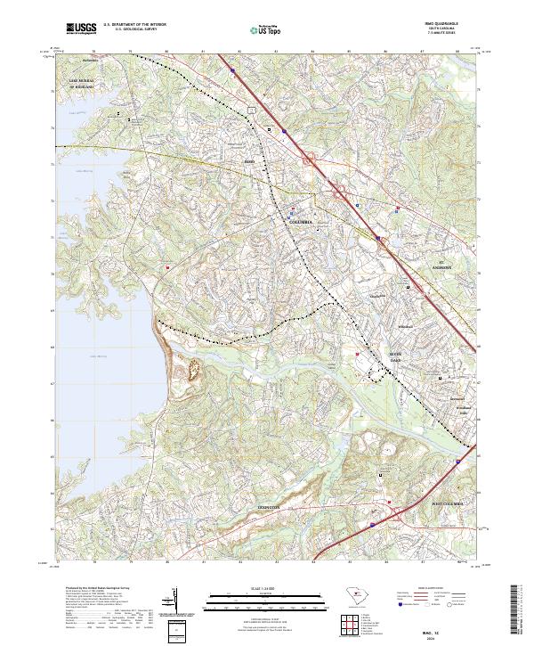
2024 Map of Irmo
USGS Topo · Published 2024About this map
The Saluda River corridor defines the boundary between Richland and Lexington Counties, cutting through a landscape of modern suburban development and preserved local history. To the west, the massive expanse of Lake Murray dominates the terrain, with Rocky Point extending into the waters of this significant regional reservoir. The map documents the dense residential growth of Columbia and its satellite communities, including Irmo, Seven Oaks, and St. Andrews. For genealogists and local historians, the sheet is a vital record of older community landmarks, preserving the locations of numerous burial grounds such as the Saint Andrews Church Graveyard, Zion Church Graveyard, and Upper Pine Grove Cem. The intricate network of waterways, including Fourteenmile Creek and Rawls Creek, continues to shape the topography of these expanding South Carolina neighborhoods.
Find a feature on this map
45 named features on this map. Tap any name to fly to it.
Don’t see what you’re looking for? This feature index may not catch every label — zoom into the map to look around manually.
Map Details
Editions of this 2024 Irmo Map
This is the sole edition of this map. No revisions or reprints were ever made.
Other maps of this area

1904 · Columbia
USGS Topo · 1:125,000

1941 · Spartanburg
USGS Topo · 1:250,000

1944 · Gilbert
USGS Topo · 1:62,500

1944 · Edmund
USGS Topo · 1:62,500

1946 · Irmo
USGS Topo · 1:24,000

1947 · Columbia North
USGS Topo · 1:24,000

1947 · Richtex
USGS Topo · 1:24,000

1948 · Irmo
USGS Topo · 1:24,000

1948 · Columbia North
USGS Topo · 1:24,000

1949 · Richtex
USGS Topo · 1:24,000