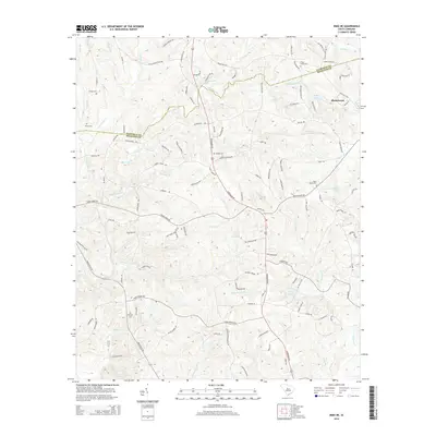
2014 Map of Irmo NE
USGS Topo · Published 2014About this map
Blythewood sits at the heart of this South Carolina landscape where the upper reaches of the coastal plain meet the Piedmont. The terrain is defined by a dense network of creek systems including Big Cedar Cr, Elkins Cr, and Swygert Cr, which have historically shaped the settlement patterns and road layouts in this portion of Richland and Fairfield counties. Local genealogy and land use are evidenced by numerous family and community burial sites scattered across the countryside, such as Beulah Cem, Saint Marks Cem, and Shiloh Cem. Small water bodies like Keels Lake and Mullers Lake dot the area, often associated with private landholdings. This 2014 survey documents the modern suburban expansion and the preservation of rural landmarks, tracing how older routes like Monticello Rd and Camp Ground Rd continue to anchor the community structure amidst evolving residential development.
Find a feature on this map
115 named features on this map. Tap any name to fly to it.
Don’t see what you’re looking for? This feature index may not catch every label — zoom into the map to look around manually.
Map Details
Editions of this 2014 Irmo NE Map
This is the sole edition of this map. No revisions or reprints were ever made.
Other maps of this area

1904 · Columbia
USGS Topo · 1:125,000

1935 · Killian
USGS Topo · 1:48,000

1937 · Killian
USGS Topo · 1:62,500

1941 · Spartanburg
USGS Topo · 1:250,000

1942 · Camden
USGS Topo · 1:125,000

1946 · Irmo
USGS Topo · 1:24,000

1947 · Columbia North
USGS Topo · 1:24,000

1947 · Richtex
USGS Topo · 1:24,000

1948 · Irmo
USGS Topo · 1:24,000

1948 · Columbia North
USGS Topo · 1:24,000