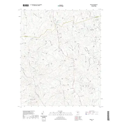
2020 Map of Irmo NE
USGS Topo · Published 2020About this map
The town of Blythewood serves as the primary hub on this Richland County landscape, situated near the headwaters of Horse Cr and Mullers Lake. The terrain is defined by a dense network of tributaries including Big Cedar Cr, Little Cedar Cr, and the winding Persimmon Fork. These waterways historically dictated the placement of early settlements and family homesteads, many of which are marked today by a significant concentration of rural burial grounds. Genealogists and local historians can trace the community's heritage through sites like Saint Marks Cem, Beulah Cem, and Shiloh Cem. The boundary between Fairfield Co and Richland Co cuts across the northern section, while numerous family-named roads like Broom Mill Rd and Muller Rd suggest the agricultural and industrial roots of the local economy before contemporary residential growth expanded outward.
Find a feature on this map
132 named features on this map. Tap any name to fly to it.
Don’t see what you’re looking for? This feature index may not catch every label — zoom into the map to look around manually.
Map Details
Editions of this 2020 Irmo NE Map
This is the sole edition of this map. No revisions or reprints were ever made.
Other maps of this area

1904 · Columbia
USGS Topo · 1:125,000

1935 · Killian
USGS Topo · 1:48,000

1937 · Killian
USGS Topo · 1:62,500

1941 · Spartanburg
USGS Topo · 1:250,000

1942 · Camden
USGS Topo · 1:125,000

1946 · Irmo
USGS Topo · 1:24,000

1947 · Columbia North
USGS Topo · 1:24,000

1947 · Richtex
USGS Topo · 1:24,000

1948 · Irmo
USGS Topo · 1:24,000

1948 · Columbia North
USGS Topo · 1:24,000