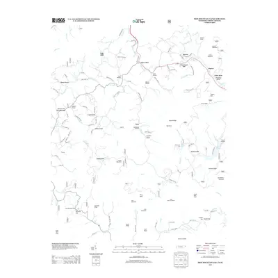
2013 Map of Iron Mountain Gap
USGS Topo · Published 2013About this map
Tiger Valley and the surrounding unincorporated communities of Tolley Town and Clarketown anchor this 2013 study of the Tennessee-North Carolina borderlands. The landscape is defined by the high ridges of Iron Mountain and Laurel Mountain, where the terrain dictates a network of hollows such as Stillhouse Hollow and Blevins Hollow. This era of the landscape shows the integration of recreational and rural interests, featuring the Clyde Smith Trail Shelter and Camp Pleiades alongside local infrastructure like the Old Railroad Grade Rd. Waterways including the Little Doe River and Tiger Creek carve through the topography, supporting small settlements like Piney Grove and White Rock. The presence of Miller Lake and Ripshin Lake on Ripshin Ridge provides a clear view of the area's upland water management and community geography.
Find a feature on this map
119 named features on this map. Tap any name to fly to it.
Don’t see what you’re looking for? This feature index may not catch every label — zoom into the map to look around manually.
Map Details
Editions of this 2013 Iron Mountain Gap Map
This is the sole edition of this map. No revisions or reprints were ever made.
Other maps of this area

1891 · Roan Mountain
USGS Topo · 1:125,000

1894 · Roan Mountain
USGS Topo · 1:125,000

1904 · Roan Mountain
USGS Topo · 1:125,000

1934 · White Rocks Mtn
USGS Topo · 1:24,000

1934 · Bakersville
USGS Topo · 1:24,000

1934 · Iron Mtn Gap
USGS Topo · 1:24,000
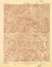
1934 · Carvers Gap
USGS Topo · 1:24,000

1935 · Watauga Valley
USGS Topo · 1:48,000

1935 · Huntdale
USGS Topo · 1:24,000

1935 · Elizabethton
USGS Topo · 1:24,000