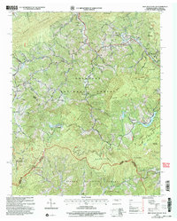
2003 Map of Iron Mountain Gap
USGS Topo · Published 2004About this map
Tiger Valley and the surrounding highlands are documented here at the intersection of the Cherokee National Forest and Pisgah National Forest. This mapping preserves a complex network of upland family cemeteries and small rural congregations, such as the Woodby Hill Cem and Piney Grove Ch, reflecting the deep-seated settlement patterns along the Tennessee and North Carolina border. The Appalachian Trail follows the high ridgeline through Iron Mountain Gap, passing landmark elevations like Little Bald Knob and Little Rock Knob. Distinctive local infrastructure is visible near Clarketown, where Minnow Rearing Pools are situated along the drainage of Clarke Creek. The geography is defined by the steep descent of the Little Doe River and Tiger Creek, where small settlements like Hopson emerged at the feet of Stone Mountain and Laurel Ridge.
Find a feature on this map
98 named features on this map. Tap any name to fly to it.
Don’t see what you’re looking for? This feature index may not catch every label — zoom into the map to look around manually.
Map Details
Editions of this 2003 Iron Mountain Gap Map
This is the sole edition of this map. No revisions or reprints were ever made.
Other maps of this area

1891 · Roan Mountain
USGS Topo · 1:125,000

1894 · Roan Mountain
USGS Topo · 1:125,000

1904 · Roan Mountain
USGS Topo · 1:125,000

1934 · White Rocks Mtn
USGS Topo · 1:24,000

1934 · Bakersville
USGS Topo · 1:24,000

1934 · Iron Mtn Gap
USGS Topo · 1:24,000
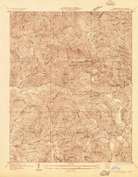
1934 · Carvers Gap
USGS Topo · 1:24,000

1935 · Watauga Valley
USGS Topo · 1:48,000

1935 · Huntdale
USGS Topo · 1:24,000

1935 · Elizabethton
USGS Topo · 1:24,000