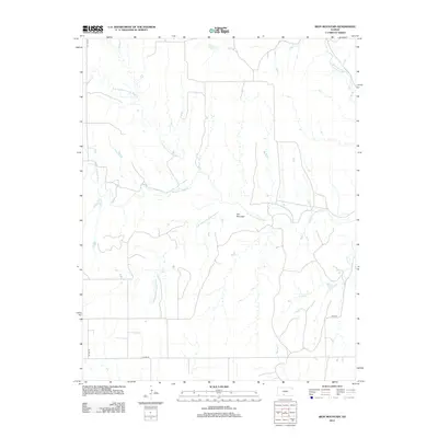
2012 Map of Iron Mountain
USGS Topo · Published 2012About this map
Iron Mountain rises above the rolling drainage basin of the central Kansas prairie, serving as a primary landmark in this rural landscape. The topography is defined by the branching waters of the Medicine Lodge River, including the N Br Medicine Lodge River and the S Br Medicine Lodge River. These waterways, along with tributaries like Otter Cr and Thompson Cr, illustrate the natural drainage patterns that have dictated land use and property boundaries in Kiowa County for generations. A sparse network of rural routes, including Coline Rd and 70th Rd, provides access across the open terrain. The map captures the quiet, agrarian character of the region, where the intersection of water and land remains the most prominent feature of the local geography.
Find a feature on this map
10 named features on this map. Tap any name to fly to it.
Don’t see what you’re looking for? This feature index may not catch every label — zoom into the map to look around manually.
Map Details
Editions of this 2012 Iron Mountain Map
This is the sole edition of this map. No revisions or reprints were ever made.
Other maps of this area

1889 · Kinsley
USGS Topo · 1:125,000

1892 · Kinsley
USGS Topo · 1:125,000

1892 · Coldwater
USGS Topo · 1:125,000

1894 · Kinsley
USGS Topo · 1:125,000

1955 · Pratt
USGS Topo · 1:250,000

1959 · Pratt
USGS Topo · 1:250,000

1968 · Wilmore SE
USGS Topo · 1:24,000

1968 · Belvidere
USGS Topo · 1:24,000

1968 · Haviland
USGS Topo · 1:24,000

1968 · Brenham
USGS Topo · 1:24,000