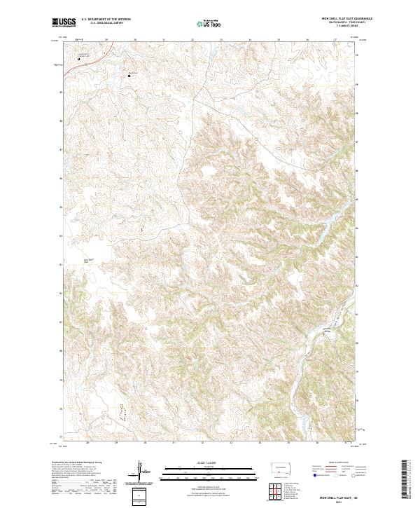
2021 Map of Iron Shell Flat East
USGS Topo · Published 2021About this map
Iron Shell Flat serves as the focal point of this high-plains landscape in Todd County, characterized by a complex network of drainages feeding into the Little White River. The map documents a sparsely populated area where local history is anchored by the Sacred Heart Catholic Cem and Peyote Cem, situated near the headwaters of Cut Meat Cr. These sites, along with Valandra Bridge in the southeastern portion, mark the primary human imprints on a terrain otherwise defined by deep breaks and canyons. The presence of Crazy Horse Canyon and multiple seasonal waterways like Beads Creek and White Horse Cr illustrates the deeply eroded topography typical of the region's southern river valleys.
Find a feature on this map
21 named features on this map. Tap any name to fly to it.
Don’t see what you’re looking for? This feature index may not catch every label — zoom into the map to look around manually.
Map Details
Editions of this 2021 Iron Shell Flat East Map
This is the sole edition of this map. No revisions or reprints were ever made.
Other maps of this area

1955 · Martin
USGS Topo · 1:250,000

1958 · Martin
USGS Topo · 1:250,000

1969 · Eagle Mans Butte
USGS Topo · 1:24,000

1969 · Soldier Creek
USGS Topo · 1:24,000

1969 · Parmelee
USGS Topo · 1:24,000

1969 · Iron Shell Flat East
USGS Topo · 1:24,000

1969 · Spring Creek SW
USGS Topo · 1:24,000

1969 · Iron Shell Flat West
USGS Topo · 1:24,000

1969 · Spring Creek
USGS Topo · 1:24,000

1969 · St. Francis SW
USGS Topo · 1:24,000
Featured Places
- Upper Cut Meat, Upper Cut Meat Segment
- Grass Mountain Segment, SD
- He Dog, SD
- Upper Cut Meat Segment, SD
- Spring Creek Segment, SD