
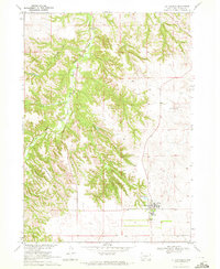
1969 Map of Soldier Creek
USGS Topo · Published 1971About this map
The Little White River winds through the heart of the Rosebud Indian Reservation, cutting a deep valley across this South Dakota landscape in the late 1960s. The settlement of Soldier Creek sits near the river's bend, serving as a focal point for a community defined by its remote country churches and burial grounds. Genealogists will find several spiritual and commemorative sites, including St Marys Ch, St Marks Ch, St Rose Ch, and Grace Ch, alongside the Salt Camp Cem and Ironwood Cem.
Find a feature on this map
24 named features on this map. Tap any name to fly to it.
Don’t see what you’re looking for? This feature index may not catch every label — zoom into the map to look around manually.
Map Details
Editions of this 1969 Soldier Creek Map
This is the sole edition of this map. No revisions or reprints were ever made.
Other maps of this area

1955 · Martin
USGS Topo · 1:250,000

1958 · Martin
USGS Topo · 1:250,000

1969 · Soldier Creek NE
USGS Topo · 1:24,000

1969 · Parmelee NE
USGS Topo · 1:24,000

1969 · Parmelee
USGS Topo · 1:24,000

1969 · Soldier Creek NW
USGS Topo · 1:24,000

1969 · Iron Shell Flat East
USGS Topo · 1:24,000

1969 · Soldier Creek SE
USGS Topo · 1:24,000

1969 · Rosebud
USGS Topo · 1:24,000
1969 · St. Francis
USGS Topo · 1:24,000
Featured Places
- Rosebud, SD
- Soldier Creek Segment, SD
- Grass Mountain Segment, SD
- Grass Mountain, Grass Mountain Segment
- Soldier Creek, Soldier Creek Segment