
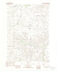
1969 Map of Soldier Creek NW
USGS Topo · Published 1971About this map
The Rosebud Indian Reservation landscape is defined by the winding drainages of Cut Meat Creek and Pine Creek as they cut through the high plains. This late 1960s survey documents a rural expanse where the local infrastructure is centered around landmarks like the Holy Family Cem and small rural institutions. The educational footprint of the era is preserved through the locations of the Ring Thunder Sch and Surprise Valley Sch, serving their respective namesake regions of Ring Thunder and Surprise Valley. The map also captures the Mellette Co Todd Co line and the settlement of Graves, showing how administrative boundaries and small communities were integrated into the topography before modern development. Notable watercourses like Gray Eagletail Creek illustrate the natural drainage patterns that have historically dictated land use and travel in this part of South Dakota.
Find a feature on this map
14 named features on this map. Tap any name to fly to it.
Don’t see what you’re looking for? This feature index may not catch every label — zoom into the map to look around manually.
Map Details
Editions of this 1969 Soldier Creek NW Map
This is the sole edition of this map. No revisions or reprints were ever made.
Other maps of this area

1955 · Martin
USGS Topo · 1:250,000

1958 · Martin
USGS Topo · 1:250,000

1969 · Soldier Creek NE
USGS Topo · 1:24,000

1969 · Parmelee NE
USGS Topo · 1:24,000

1969 · Soldier Creek
USGS Topo · 1:24,000

1969 · Parmelee
USGS Topo · 1:24,000

1969 · Soldier Creek SE
USGS Topo · 1:24,000

1980 · Kadoka
USGS Topo · 1:100,000

1981 · Cedar Butte
USGS Topo · 1:25,000
1982 · Murdo 3 NW
USGS Topo · 1:25,000