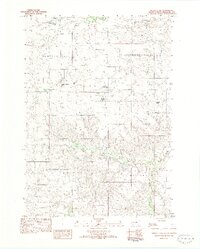
1982 Map of Murdo 3 NW
USGS Topo · Published 1982About this map
The wide, ranching landscape of Mellette County is defined here by a series of family-held properties and deep drainage valleys. Local history is tied to specific homesteads such as the Jarl-Knispel Ranch, Harris Ranch, and a cluster of Chamberlain family sites including the Marvin Chamberlain Ranch and Charles Chamberlain Ranch. This 1982 provisional survey reflects the enduring cattle-rearing economy of South Dakota's interior, where land is organized around vital water sources like Cottonwood Creek and the bifurcating paths of the North Branch Pine Creek and South Branch Pine Creek. The terrain transitions from the upland heights of Running Bird into the broad expanses of Cottonwood Valley and Surprise Valley, illustrating the complex network of draws and ridges that dictated settlement patterns and grazing routes.
Find a feature on this map
14 named features on this map. Tap any name to fly to it.
Don’t see what you’re looking for? This feature index may not catch every label — zoom into the map to look around manually.
Map Details
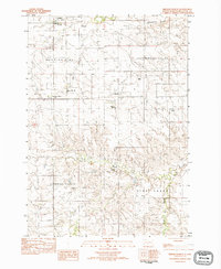
Editions of this 1982 Murdo 3 NW Map
2 editions found
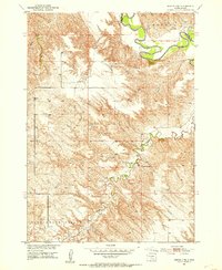
Other maps of this area

1951 · Cedar Butte NE
USGS Topo · 1:24,000
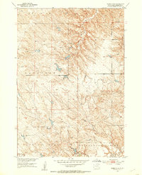
1951 · Murdo 3 NW
USGS Topo · 1:24,000
1951 · Murdo 3 NE
USGS Topo · 1:24,000

1955 · Martin
USGS Topo · 1:250,000

1958 · Martin
USGS Topo · 1:250,000

1969 · Soldier Creek NE
USGS Topo · 1:24,000

1969 · Parmelee NE
USGS Topo · 1:24,000

1969 · Soldier Creek NW
USGS Topo · 1:24,000

1980 · Kadoka
USGS Topo · 1:100,000

1981 · Cedar Butte
USGS Topo · 1:25,000