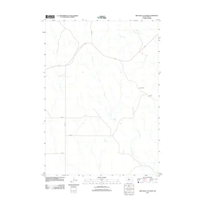
2012 Map of Iron Shell Flat West
USGS Topo · Published 2012About this map
Iron Shell Flat characterizes the wide, open landscape of this 2012 survey, where the drainages of Cut Meat Cr, Coffee Cr, and Running Enemy Cr carve subtle pathways through the terrain. The geography is defined by a sparse network of section-line roads, including 292nd St and 244th Ave, reflecting the systematic grid of rural South Dakota. The presence of Saint Marys Cem near the eastern edge provides a localized point of historical and genealogical significance, serving as a landmark within this expansive area. He Dog Rd cuts across the northern section, connecting the remote flats with the broader regional road system. This map captures the modern footprint of a landscape that remains largely defined by its natural hydrology and the persistent layout of its rural infrastructure.
Find a feature on this map
10 named features on this map. Tap any name to fly to it.
Don’t see what you’re looking for? This feature index may not catch every label — zoom into the map to look around manually.
Map Details
Editions of this 2012 Iron Shell Flat West Map
This is the sole edition of this map. No revisions or reprints were ever made.
Other maps of this area
1955 · Martin
USGS Topo · 1:250,000
1958 · Martin
USGS Topo · 1:250,000
1969 · Eagle Mans Butte
USGS Topo · 1:24,000
1969 · Parmelee
USGS Topo · 1:24,000
1969 · Iron Shell Flat East
USGS Topo · 1:24,000
1969 · Spring Creek SW
USGS Topo · 1:24,000
1969 · Iron Shell Flat West
USGS Topo · 1:24,000
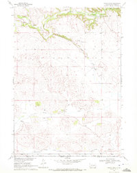
1969 · Spring Creek
USGS Topo · 1:24,000
1981 · Blackpipe
USGS Topo · 1:25,000
1981 · Scotchman Lake
USGS Topo · 1:25,000