
1981 Map of Blackpipe
USGS Topo · Published 1981About this map
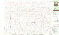
Blackpipe sits within the undulating landscape of Bennett County, where the drainage of Black Pipe Creek and Pass Creek shapes the local topography. This 1981 edition, based on aerial photography from the mid-1970s, captures the rural character of south-central South Dakota during a period of steady land use. The presence of the Pleasant Valley Sch suggests a community structure centered around localized education and agricultural ranching. The terrain is defined by distinct landmarks such as Brushy Butte, while water management is evidenced by the Scharman Dam and the shoreline of White Lake to the southwest. The map provides a clear record of the section lines and rural tracks that networked these isolated settlements and landmarks before the digital era.
Find a feature on this map
9 named features on this map. Tap any name to fly to it.
Don’t see what you’re looking for? This feature index may not catch every label — zoom into the map to look around manually.
Map Details
Editions of this 1981 Blackpipe Map
This is the sole edition of this map. No revisions or reprints were ever made.
Other maps of this area

1955 · Martin
USGS Topo · 1:250,000

1958 · Martin
USGS Topo · 1:250,000

1969 · Norris
USGS Topo · 1:24,000

1969 · Eagle Mans Butte
USGS Topo · 1:24,000

1969 · Iron Shell Flat West
USGS Topo · 1:24,000

1981 · Long Valley
USGS Topo · 1:25,000

1981 · Patricia
USGS Topo · 1:25,000

1981 · Martin
USGS Topo · 1:25,000
1981 · Buzzard Butte
USGS Topo · 1:25,000

1981 · Tuthill
USGS Topo · 1:25,000