
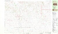
1981 Map of Long Valley
USGS Topo · Published 1981About this map
The Long Valley community and the Pine Ridge Indian Reservation Boundary anchor this Jackson County landscape in the early 1980s. The terrain is defined by a dense network of intermittent drainages, including Pass Creek, Water Hole Creek, and Bull Creek, which carve through the plains. Local social life and rural infrastructure are marked by specific landmarks such as the Rodeo Ground near the settlement and the Hawkwing Cemetery further east. This 1:25,000 scale map reveals a region of low-density habitation where water sources are vital, indicated by several Well sites and small stock ponds. The boundary between Jackson and Bennett counties runs across the southern portion of the sheet, while evidence of local industry appears at the Gravel Pit near Buzzard Creek.
Find a feature on this map
16 named features on this map. Tap any name to fly to it.
Don’t see what you’re looking for? This feature index may not catch every label — zoom into the map to look around manually.
Map Details
Editions of this 1981 Long Valley Map
This is the sole edition of this map. No revisions or reprints were ever made.
Other maps of this area

1955 · Martin
USGS Topo · 1:250,000

1958 · Martin
USGS Topo · 1:250,000

1969 · Norris
USGS Topo · 1:24,000

1969 · Eagle Mans Butte
USGS Topo · 1:24,000

1980 · Kadoka
USGS Topo · 1:100,000

1981 · Cedar Butte
USGS Topo · 1:25,000

1981 · Patricia
USGS Topo · 1:25,000

1981 · Broken Leg Dam
USGS Topo · 1:24,000

1981 · Blackpipe
USGS Topo · 1:25,000
1981 · Short Bow Creek
USGS Topo · 1:25,000