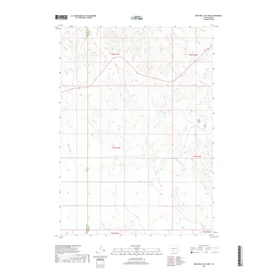
2017 Map of Iron Shell Flat West
USGS Topo · Published 2017About this map
Iron Shell Flat anchors the landscape of the South Dakota plains, situated along the jurisdictional boundary of Bennett and Todd counties. This 2017 survey by the U.S. Geological Survey shows a sparsely settled region defined by its hydrography and agricultural grid. The drainage of Cut Meat Cr in the north and the winding path of Running Enemy Cr in the south suggest the undulating terrain of the northern Great Plains. For genealogists and local historians, the placement of Saint Mary's Cem on the eastern edge of the flat provides a specific point of interest in an area otherwise characterized by sectional lines and secondary routes like Hc 77 and Co Line Rd W. The map documents the persistent layout of Public Land Survey System townships, including t37n r33w, in the early 21st century.
Find a feature on this map
14 named features on this map. Tap any name to fly to it.
Don’t see what you’re looking for? This feature index may not catch every label — zoom into the map to look around manually.
Map Details
Editions of this 2017 Iron Shell Flat West Map
This is the sole edition of this map. No revisions or reprints were ever made.
Other maps of this area

1955 · Martin
USGS Topo · 1:250,000

1958 · Martin
USGS Topo · 1:250,000

1969 · Eagle Mans Butte
USGS Topo · 1:24,000

1969 · Parmelee
USGS Topo · 1:24,000

1969 · Iron Shell Flat East
USGS Topo · 1:24,000

1969 · Spring Creek SW
USGS Topo · 1:24,000

1969 · Iron Shell Flat West
USGS Topo · 1:24,000

1969 · Spring Creek
USGS Topo · 1:24,000

1981 · Blackpipe
USGS Topo · 1:25,000

1981 · Scotchman Lake
USGS Topo · 1:25,000