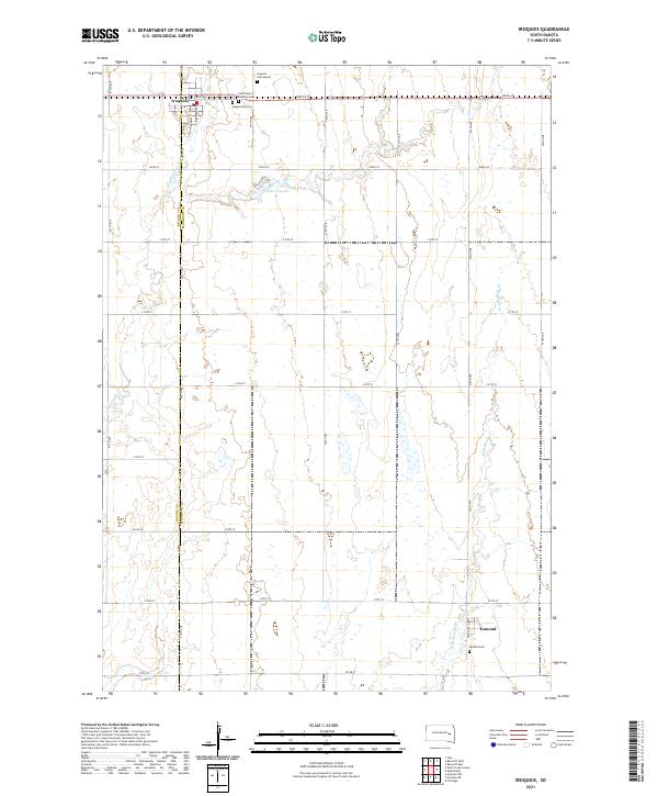
2021 Map of Iroquois
USGS Topo · Published 2021About this map
Iroquois sits at the northern edge of this prairie landscape, where the local grid of gravel roads and section lines defines the agricultural character of eastern South Dakota. The town is marked by its residential streets like S Ottawa St and S Quapaw St, and serves as a central point for surrounding rural cemeteries including Maplewood Cem and the Iroquois Cem Mound. To the south, the smaller settlement of Esmond anchors the lower reaches of the quadrangle near the Esmond Cem. The terrain is shaped by the gentle drainage of S Fork Pearl Cr and W Redstone Cr, which wind through the township ranges. A notable geographic feature is Lake Iroquois, providing a rare body of open water in a region dominated by seasonal wetlands and the steady geometry of the Section Land System along the Beadle Co Kingsbury Co line.
Find a feature on this map
32 named features on this map. Tap any name to fly to it.
Don’t see what you’re looking for? This feature index may not catch every label — zoom into the map to look around manually.
Map Details
Editions of this 2021 Iroquois Map
This is the sole edition of this map. No revisions or reprints were ever made.
Other maps of this area

1899 · De Smet
USGS Topo · 1:125,000

1953 · Watertown
USGS Topo · 1:250,000

1958 · Watertown
USGS Topo · 1:250,000

1971 · Iroquois
USGS Topo · 1:24,000
1971 · Artesian NW
USGS Topo · 1:24,000
1971 · Pearl Creek Colony
USGS Topo · 1:24,000

1971 · Bancroft East
USGS Topo · 1:24,000

1971 · Bancroft West
USGS Topo · 1:24,000
1971 · Yale
USGS Topo · 1:24,000

1971 · Artesian NE
USGS Topo · 1:24,000