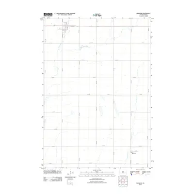
2012 Map of Iroquois
USGS Topo · Published 2012About this map
Esmond sits at the southern edge of this Kingsbury County landscape, where the local street grid of Main St and Elm St meets the section lines of the South Dakota prairie. The terrain is defined by the winding paths of W Redstone Cr and S Fork Pearl Cr, which drain the open agricultural lands between the cardinal-point avenues. To the north, Lake Iroquois provides a central hydrographic feature near the municipal street system of Iroquois, including Oswego St and S Sioux St. This 2012 survey illustrates the enduring township-and-range layout of the Great Plains, where the vast majority of the land is divided into systematic squares by routes like 420th Ave and 212th St, reflecting a century of rural development and land management.
Find a feature on this map
26 named features on this map. Tap any name to fly to it.
Don’t see what you’re looking for? This feature index may not catch every label — zoom into the map to look around manually.
Map Details
Editions of this 2012 Iroquois Map
This is the sole edition of this map. No revisions or reprints were ever made.
Other maps of this area

1899 · De Smet
USGS Topo · 1:125,000

1953 · Watertown
USGS Topo · 1:250,000

1958 · Watertown
USGS Topo · 1:250,000

1971 · Iroquois
USGS Topo · 1:24,000
1971 · Artesian NW
USGS Topo · 1:24,000
1971 · Pearl Creek Colony
USGS Topo · 1:24,000

1971 · Bancroft East
USGS Topo · 1:24,000

1971 · Bancroft West
USGS Topo · 1:24,000
1971 · Yale
USGS Topo · 1:24,000

1971 · Artesian NE
USGS Topo · 1:24,000