Loading...
Loading map...2022 Map of Irvine
USGS Topo · Published 2022About this map
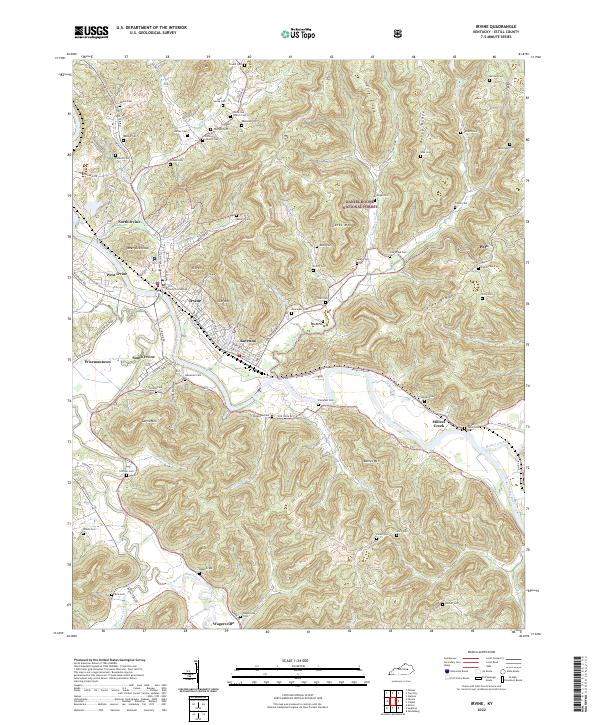
Irvine and Ravenna sit at the center of this Kentucky landscape, where the Kentucky River carves a deep path through the eastern foothills. The town of Irvine serves as the focal point, housing the Estill County Courthouse and connecting the surrounding communities of North Irvine, West Irvine, and South Irvine. To the east, the terrain rises into the Daniel Boone National Forest, characterized by prominent high points like Sparks Mtn, Star Mtn, and the long stretch of Tipton Ridge.
Find a feature on this map
110 named features on this map. Tap any name to fly to it.
Don’t see what you’re looking for? This feature index may not catch every label — zoom into the map to look around manually.
Map Details
Date Portrayed2022
Date Published2022
PublisherU.S. Geological Survey
Map TypeTopographic
Scale1:24000
Physical Dimensions24 x 29 inches
Editions of this 2022 Irvine Map
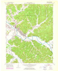
This is the sole edition of this map. No revisions or reprints were ever made.
Historical Maps of North Irvine Through Time

Featured Locations
Source Details
SourceU.S. Geological Survey
CopyrightPublic Domain