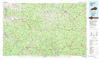
1982 Map of Irvine
USGS Topo · Published 1983About this map
Irvine and Ravenna anchor the western edge of this 1982 topographic study, where the Kentucky River winds through the hills of Estill County. The landscape is defined by the extensive reach of the Daniel Boone National Forest, protecting the dramatic geology of Natural Bridge State Park and the sandstone formations of the Natural Bridge itself. The region’s infrastructure is visible in the paths of the Louisville & Nashville RR and the Chesapeake & Ohio RR, which trace the river valleys to support the timber and mineral interests of the era.
Find a feature on this map
140 named features on this map. Tap any name to fly to it.
Don’t see what you’re looking for? This feature index may not catch every label — zoom into the map to look around manually.
Map Details
Editions of this 1982 Irvine Map
This is the sole edition of this map. No revisions or reprints were ever made.
Other maps of this area

1886 · Prestonsburg
USGS Topo · 1:125,000

1889 · Salyersville
USGS Topo · 1:125,000

1890 · Whitesburg
USGS Topo · 1:125,000

1891 · Manchester
USGS Topo · 1:125,000

1891 · Hazard
USGS Topo · 1:125,000

1891 · Salyersville
USGS Topo · 1:125,000

1892 · Whitesburg
USGS Topo · 1:125,000

1892 · Richmond
USGS Topo · 1:125,000

1892 · Prestonsburg
USGS Topo · 1:125,000

1892 · Beattyville
USGS Topo · 1:125,000