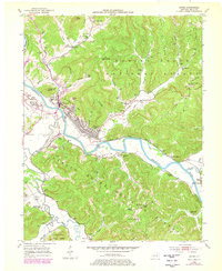
1952 Map of Irvine
USGS Topo · Published 1978About this map
The Kentucky River winds through the heart of Estill County, serving as the industrial and topographic anchor for the twin towns of Irvine and Ravenna. During the early 1950s, this area functioned as a vital hub for the Louisville and Nashville railroad, which parallels the river and supports the local coal and timber economy. The landscape is characterized by narrow valleys and prominent heights like Sweet Lick Knob and Henry Mtn, while the Daniel Boone National Forest dominates the eastern and southern ridges.
Find a feature on this map
95 named features on this map. Tap any name to fly to it.
Don’t see what you’re looking for? This feature index may not catch every label — zoom into the map to look around manually.
Map Details
Editions of this 1952 Irvine Map
3 editions found

Other maps of this area

1892 · Richmond
USGS Topo · 1:125,000

1892 · Beattyville
USGS Topo · 1:125,000

1897 · Richmond
USGS Topo · 1:125,000

1952 · Alcorn
USGS Topo · 1:24,000

1952 · Leighton
USGS Topo · 1:24,000

1952 · Palmer
USGS Topo · 1:24,000

1952 · Clay City
USGS Topo · 1:24,000

1952 · Stanton
USGS Topo · 1:24,000

1952 · Cobhill
USGS Topo · 1:24,000

1952 · Heidelberg
USGS Topo · 1:24,000