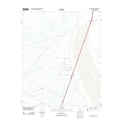
2012 Map of Ivanpah Lake
USGS Topo · Published 2012About this map
Primm stands as a distinct island of human development against the desert floor where Nevada meets California. The settlement's layout is closely tied to the transportation artery of Las Vegas Blvd S, with local commerce represented by the presence of Fashion Outlet Way. The geography is dominated by the expanse of Ivanpah Lake, a dry bed that transitions into the western slopes of the mountains, cut by the seasonal drainage of Antimony Gulch. Residential and service streets like Densmore Dr and Saragossa Dr show the footprint of this border outpost in the early 21st century. Away from the town center, the landscape is crisscrossed by desert routes such as Yates Well Rd and Silverton Rd, indicating access points to the surrounding arid terrain and industrial or mining sites beyond the immediate settlement.
Find a feature on this map
13 named features on this map. Tap any name to fly to it.
Don’t see what you’re looking for? This feature index may not catch every label — zoom into the map to look around manually.
Map Details
Editions of this 2012 Ivanpah Lake Map
This is the sole edition of this map. No revisions or reprints were ever made.
Other maps of this area

1910 · Ivanpah
USGS Topo · 1:250,000

1912 · Ivanpah
USGS Topo · 1:250,000

1942 · Ivanpah
USGS Topo · 1:250,000

1947 · Kingman
USGS Topo · 1:250,000

1948 · Kingman
USGS Topo · 1:250,000

1954 · Kingman
USGS Topo · 1:250,000

1955 · Kingman
USGS Topo · 1:250,000

1955 · Mescal Range
USGS Topo · 1:62,500

1955 · Roach Lake
USGS Topo · 1:62,500

1956 · Ivanpah
USGS Topo · 1:62,500