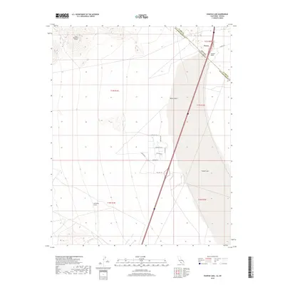
2018 Map of Ivanpah Lake
USGS Topo · Published 2018About this map
Primm sits as a significant gateway on this 2018 survey, straddling the state line where the Nevada California border intersects the Ivanpah Valley. This arid landscape is dominated by the dry expanse of Ivanpah Lake and the eastern fringes of the Mojave Desert. The topography rises sharply to the northwest into the Clark Mountain Range, where steep contours define the local relief. The transition from the valley floor into the mountains is marked by drainage features such as Antimony Gulch. Significant modern infrastructure is visible near the border, including a developed street network with names like Silverton Rd and Dalmatia Rd, reflecting the area's role as a commercial and transit hub. The map provides a precise record of the desert's high-contrast geography, from the flat playa to the rugged slopes of the Clark range.
Find a feature on this map
23 named features on this map. Tap any name to fly to it.
Don’t see what you’re looking for? This feature index may not catch every label — zoom into the map to look around manually.
Map Details
Editions of this 2018 Ivanpah Lake Map
This is the sole edition of this map. No revisions or reprints were ever made.
Other maps of this area

1910 · Ivanpah
USGS Topo · 1:250,000

1912 · Ivanpah
USGS Topo · 1:250,000

1942 · Ivanpah
USGS Topo · 1:250,000

1947 · Kingman
USGS Topo · 1:250,000

1948 · Kingman
USGS Topo · 1:250,000

1954 · Kingman
USGS Topo · 1:250,000

1955 · Kingman
USGS Topo · 1:250,000

1955 · Mescal Range
USGS Topo · 1:62,500

1955 · Roach Lake
USGS Topo · 1:62,500

1956 · Ivanpah
USGS Topo · 1:62,500