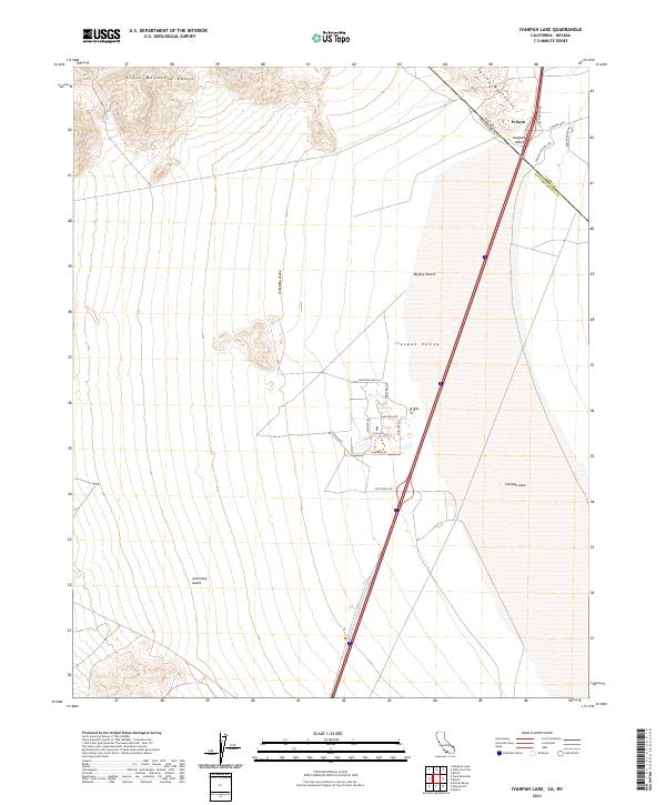
2021 Map of Ivanpah Lake
USGS Topo · Published 2021About this map
Ivanpah Lake dominates the eastern basin of this high desert landscape, straddling the state line where Mojave Desert terrain meets the developed corridor of Primm. The settlement at Primm serves as a distinctive gateway between Nevada and California, characterized by a concentration of commercial infrastructure including Fashion Outlet Way and S Las Vegas Blvd. This proximity to the state border highlights the area's role as a transit hub and recreational threshold, with the dry lake bed providing a stark, flat contrast to the rising elevations of the surrounding mountains.
Find a feature on this map
27 named features on this map. Tap any name to fly to it.
Don’t see what you’re looking for? This feature index may not catch every label — zoom into the map to look around manually.
Map Details
Editions of this 2021 Ivanpah Lake Map
This is the sole edition of this map. No revisions or reprints were ever made.
Other maps of this area

1910 · Ivanpah
USGS Topo · 1:250,000

1912 · Ivanpah
USGS Topo · 1:250,000

1942 · Ivanpah
USGS Topo · 1:250,000

1947 · Kingman
USGS Topo · 1:250,000

1948 · Kingman
USGS Topo · 1:250,000

1954 · Kingman
USGS Topo · 1:250,000

1955 · Kingman
USGS Topo · 1:250,000

1955 · Mescal Range
USGS Topo · 1:62,500

1955 · Roach Lake
USGS Topo · 1:62,500

1956 · Ivanpah
USGS Topo · 1:62,500