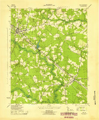
1945 Map of Ivor
USGS Topo · Published 1945About this map
Wakefield and Ivor anchor this mid-century survey of the Tidewater region, where the Norfolk and Western railroad cuts a sharp diagonal through a landscape defined by an intricate network of wetlands. Small crossroads communities like Sadlers Crossroads and Camp Corner punctuate the rural interior, linked by the Smithfield and Ivor Road. The map reveals a deeply rooted social geography, preserving the locations of numerous country churches such as Mars Hill Ch and New Branch Church, alongside local educational landmarks like Coppahaunk Sch.
Find a feature on this map
33 named features on this map. Tap any name to fly to it.
Don’t see what you’re looking for? This feature index may not catch every label — zoom into the map to look around manually.
Map Details
Editions of this 1945 Ivor Map
This is the sole edition of this map. No revisions or reprints were ever made.
Other maps of this area

1919 · Surry
USGS Topo · 1:62,500

1919 · Disputanta
USGS Topo · 1:62,500

1919 · Homeville
USGS Topo · 1:48,000

1920 · Ivor
USGS Topo · 1:62,500

1920 · Homeville
USGS Topo · 1:62,500

1943 · Manry
USGS Topo · 1:31,680

1943 · Vicksville
USGS Topo · 1:31,680

1943 · Richmond
USGS Topo · 1:250,000

1944 · Waverly
USGS Topo · 1:31,680

1944 · Ivor
USGS Topo · 1:24,000