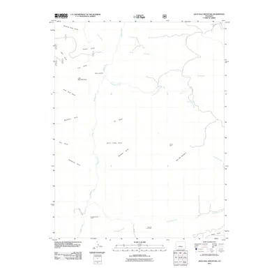
2011 Map of Jack Hall Mountain
USGS Topo · Published 2011About this map
Jack Hall Mountain and Little Baldy Mountain dominate this part of Fremont County, where the landscape is defined by a dense network of drainages and legacy mining operations. The central artery of the area is Badger Creek, which is fed by numerous tributaries including Willow Creek, Two Creek, and East Badger Creek. The naming conventions throughout the terrain reflect the area's isolation and rugged character, with labels like Tombstone Gulch, Hells Hole Gulch, and Banning Cabin Gulch suggesting the difficult nature of early passage and settlement.
Find a feature on this map
33 named features on this map. Tap any name to fly to it.
Don’t see what you’re looking for? This feature index may not catch every label — zoom into the map to look around manually.
Map Details
Editions of this 2011 Jack Hall Mountain Map
This is the sole edition of this map. No revisions or reprints were ever made.
Other maps of this area

1954 · Pueblo
USGS Topo · 1:250,000

1956 · Cameron Mountain
USGS Topo · 1:62,500

1957 · Pueblo
USGS Topo · 1:250,000

1958 · Pueblo
USGS Topo · 1:250,000

1959 · Black Mountain
USGS Topo · 1:62,500

1959 · Howard
USGS Topo · 1:62,500

1959 · Cotopaxi
USGS Topo · 1:62,500

1962 · Pueblo
USGS Topo · 1:250,000

1966 · Pueblo
USGS Topo · 1:250,000
1980 · Wellsville
USGS Topo · 1:24,000