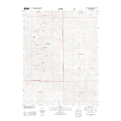
2013 Map of Jack Hall Mountain
USGS Topo · Published 2013About this map
San Isabel National Forest encompasses the vast majority of this high-altitude landscape in Fremont County. The terrain is defined by a dense network of gulches and drainages, where seasonal waters like Badger Cr and Little Badger Cr have carved deep into the mountain profile. The southern reaches are dominated by the elevation of Jack Hall Mountain, while Little Baldy Mountain stands prominently to the northwest.
Find a feature on this map
29 named features on this map. Tap any name to fly to it.
Don’t see what you’re looking for? This feature index may not catch every label — zoom into the map to look around manually.
Map Details
Editions of this 2013 Jack Hall Mountain Map
This is the sole edition of this map. No revisions or reprints were ever made.
Other maps of this area

1954 · Pueblo
USGS Topo · 1:250,000

1956 · Cameron Mountain
USGS Topo · 1:62,500

1957 · Pueblo
USGS Topo · 1:250,000

1958 · Pueblo
USGS Topo · 1:250,000

1959 · Black Mountain
USGS Topo · 1:62,500

1959 · Howard
USGS Topo · 1:62,500

1959 · Cotopaxi
USGS Topo · 1:62,500

1962 · Pueblo
USGS Topo · 1:250,000

1966 · Pueblo
USGS Topo · 1:250,000
1980 · Wellsville
USGS Topo · 1:24,000