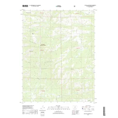
2019 Map of Jack Hall Mountain
USGS Topo · Published 2019About this map
San Isabel National Forest encompasses the high-altitude terrain of Fremont County shown in this 2019 survey. The landscape is defined by its deep drainages and prominent peaks, notably Jack Hall Mtn and Little Baldy Mtn. The naming of the numerous gulches suggests a history of local exploration and perhaps early prospecting, with colorful identifiers such as Tombstone Gulch, Banning Cabin Gulch, and Hells Hole Gulch. A network of forest and county routes, including Co RD 12 and BLM RD 5980, provides access through the watersheds of Badger Cr and Willow Cr. The map captures the intersection of several townships, showing a remote mountain environment where topography dictates the flow of commerce and movement, largely away from concentrated settlements.
Find a feature on this map
33 named features on this map. Tap any name to fly to it.
Don’t see what you’re looking for? This feature index may not catch every label — zoom into the map to look around manually.
Map Details
Editions of this 2019 Jack Hall Mountain Map
This is the sole edition of this map. No revisions or reprints were ever made.
Other maps of this area

1954 · Pueblo
USGS Topo · 1:250,000

1956 · Cameron Mountain
USGS Topo · 1:62,500

1957 · Pueblo
USGS Topo · 1:250,000

1958 · Pueblo
USGS Topo · 1:250,000

1959 · Black Mountain
USGS Topo · 1:62,500

1959 · Howard
USGS Topo · 1:62,500

1959 · Cotopaxi
USGS Topo · 1:62,500

1962 · Pueblo
USGS Topo · 1:250,000

1966 · Pueblo
USGS Topo · 1:250,000
1980 · Wellsville
USGS Topo · 1:24,000