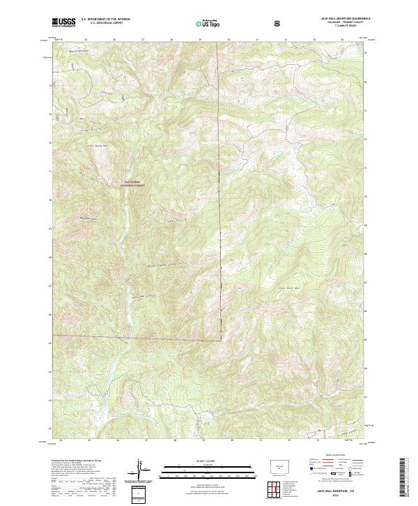
2022 Map of Jack Hall Mountain
USGS Topo · Published 2022About this map
The San Isabel National Forest dominates this section of Fremont County, where a complex network of drainages defines the high-elevation landscape. The terrain is marked by prominent peaks such as Jack Hall Mtn and Little Baldy Mtn, surrounded by deep gulches that tell a story of early exploration and resource naming. Settlers and prospectors left their mark with evocative place names like Tombstone Gulch, Banning Cabin Gulch, and Mayflower Gulch.
Find a feature on this map
29 named features on this map. Tap any name to fly to it.
Don’t see what you’re looking for? This feature index may not catch every label — zoom into the map to look around manually.
Map Details
Editions of this 2022 Jack Hall Mountain Map
This is the sole edition of this map. No revisions or reprints were ever made.
Other maps of this area

1954 · Pueblo
USGS Topo · 1:250,000

1956 · Cameron Mountain
USGS Topo · 1:62,500

1957 · Pueblo
USGS Topo · 1:250,000

1958 · Pueblo
USGS Topo · 1:250,000

1959 · Black Mountain
USGS Topo · 1:62,500

1959 · Howard
USGS Topo · 1:62,500

1959 · Cotopaxi
USGS Topo · 1:62,500

1962 · Pueblo
USGS Topo · 1:250,000

1966 · Pueblo
USGS Topo · 1:250,000
1980 · Wellsville
USGS Topo · 1:24,000