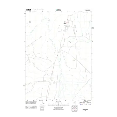
2012 Map of Jackpot
USGS Topo · Published 2012About this map
Jackpot sits at the northern edge of Elko County, serving as a gateway between Nevada and Idaho along the corridor of Old US Hwy 93. This early 21st-century landscape is defined by its ranching heritage and modern development, with themed street names such as Lady Luck Dr and Ace Dr reflecting the local economy. The terrain transitions from the high ground of Browns Bench toward the winding course of Salmon Falls Creek, which bisects the quadrangle from south to north.
Find a feature on this map
20 named features on this map. Tap any name to fly to it.
Don’t see what you’re looking for? This feature index may not catch every label — zoom into the map to look around manually.
Map Details
Editions of this 2012 Jackpot Map
This is the sole edition of this map. No revisions or reprints were ever made.
Other maps of this area

1955 · Twin Falls
USGS Topo · 1:250,000

1955 · Wells
USGS Topo · 1:250,000

1957 · Contact
USGS Topo · 1:62,500

1957 · Delaplain
USGS Topo · 1:62,500

1958 · Wells
USGS Topo · 1:250,000

1958 · Twin Falls
USGS Topo · 1:250,000

1961 · Wells
USGS Topo · 1:250,000

1977 · Browns Bench South
USGS Topo · 1:24,000

1977 · Magic Hot Springs
USGS Topo · 1:24,000
1978 · Meteor
USGS Topo · 1:24,000