2021 Map of Jackpot
USGS Topo · Published 2021About this map
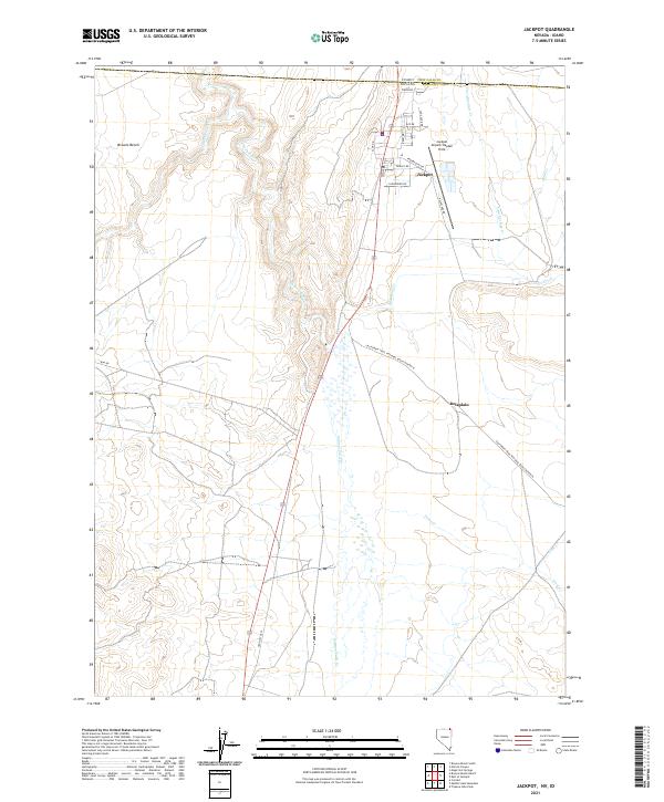
Jackpot sits directly on the high desert border between Nevada and Idaho, serving as a distinct gaming and service outpost defined by its unique street names. The town layout reflects its identity with thoroughfares like Lady Luck Dr, Pinochle St, and Keno Dr clustered near the state line. This modern landscape is bisected by the California Trail National Back Country B, a route that follows the historical migration corridor through the basin. West of the settlement, the terrain rises toward the prominent Browns Bench, while Salmon Falls Cr and its tributaries, including Shoshone Cr and Twin Springs Cr, carve through the arid plateaus. The presence of Jackpot Airport/Hayden Field and the Old Hwy Us 93 alignment shows the continued importance of this transit corridor for travelers crossing between Elko County and Twin Falls.
Find a feature on this map
30 named features on this map. Tap any name to fly to it.
Don’t see what you’re looking for? This feature index may not catch every label — zoom into the map to look around manually.
Map Details
Editions of this 2021 Jackpot Map
This is the sole edition of this map. No revisions or reprints were ever made.